Sepastia (Sivas)

Photo Credit: Maggie Blanck
The Statehouse building (built in 1884) in the main square in the center of the city of Sepastia.
The street is Inonu Boulevard, and all the major roads of the city begin here.
Sepastia is the name of both a state and a city in Armenia (now called Sivas in Turkey). The Melikian family featured on this site identify as "Sepastatsi" and many were residents of Prapert (now Günyamaç), one of many tiny villages in the area (the number of these is inconsistently reported, ranging from 50 to 350).
Sepastia is the highest city in Central Anatolia, at 4,000 ft above sea level. The city itself is the second largest city in "Asian Turkey" and is situated north of the Kizil Irmah (Red River) in a wide valley surrounded by sparsely wooded mountains. Winters are cold and severe with heavy snow. Summers are hot and dry, and the spring and fall are rainy.


The city of Sepastia was quite large. As far back as the 17th century, there were approximately 6,000 houses in Sivas. The city center is four hundred and fifty miles south-east from Constantinople, which was at least a six day journey by horse or camel.
The city had unpaved streets and was quite muddy during the rainy season. There were rough "side-walks" built with irregular round stones, no sewers and no streetlights. The population in the city at the turn of the century was about fifty thousand (which did not include the people in the villages). In the city, 36,000 people were Turks; 12,000 were Armenians, and the rest were Greeks. Half of the villages surrounding the city were Armenian.
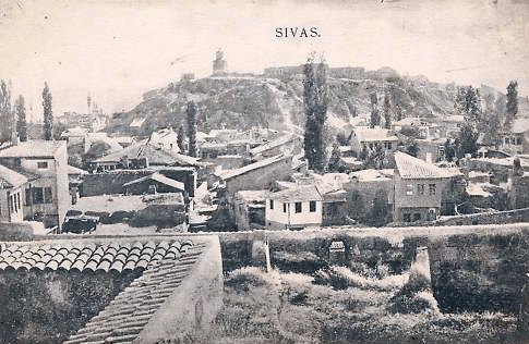
LEFT: View toward a ruined citadel on a mountain overlooking the city.
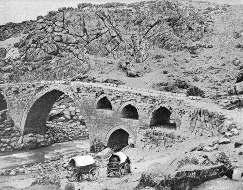
BELOW: Bridge on the road between Sepastia and Ersinjan.
Photo Credit: Maggie Blanck
Photo Credit: Maggie Blanck
There were no hotels in all of Anatolia at the turn of the century. Travelers stayed in the Khan, a type of inn. The building included an enclosed courtyard surrounded by a wall (mud or wood). The first floor contained stables, and the second floor featured rooms for guests (however many guests camped in the courtyard). Each guest brought all of his/her necessities: food, bedding, and drink. Hygiene was minimal, and many khans were full of bugs. Most western travelers only stayed in the Khan for protection from bandits, of which there were many on the roads between cities.


LEFT: Most travel was managed on horseback.
BELOW: View of a "khan" or traveler's inn.
Photo Credit: Maggie Blanck
Photo Credit: Maggie Blanck

Photo Credit: Maggie Blanck
Large Heading


Photo Credit: Maggie Blanck
Photo Credit: Maggie Blanck
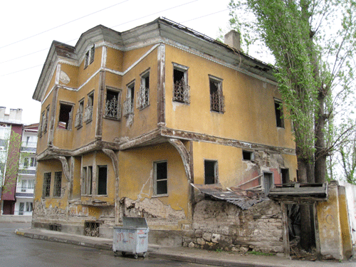
A typical style of home in the city
The same type of home today.
Until 1890, a specific type of oriental rug was made in the small villages around Sepastia. In 1890, the government established 300 looms in the city of Sepastia itself. By 1902, there were 2,000 looms in the city. In 1911, in addition rugs being made on home looms, rug factories employed thousands of "little Armenian girls." The 350 villages in the state of Sepastia had about 10,000 looms.
The railroad was finally built in Sepastia in 1930.
In May 2008, there were only 76 Armenians (forming part of 20 families) still living in the city of Sepastia.
PRAPERT TODAY
This news video covers a tree-planting project in the Melikian ancestral village of Prapert (now called Gunyamac). The introductory images are of the town of Sivas, then next 20 minutes of the video features a tour of the village of Prapert.